

Innovative components
River managers often need to reconcile conflicting objectives, but stakeholder processes are prone to subjectivity, are time consuming and therefore limited in scope. Here we present RiverScape, a modeling tool for numerical creation, positioning and implementation of seven common flood hazard reduction measures in the Netherlands. RiverScape evaluates the measures for (1) hydrodynamic effects with the 2D flow model, and (2) the required landscaping work expressed as the displaced volume of material with the Delft3D Flexible Mesh.
Findings and implications to practice
By using the RiverScape tool, we found that the most effective flood hazard reduction in terms of transported material is the removing of vegetation, followed by main embankment raising, groyne lowering, minor embankment lowering, side channel construction, floodplain lowering and relocation of the main embankments. The implementation of RiverScape may speed up decision making considerably. Applications could weigh in adverse downstream effects, degradation of the ecology and overly expensive choices.
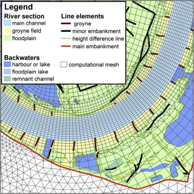
Figure shows an example of the computational mesh used in the flood model. (Source: Figure 5, Straatsma & Kleinhans, 2018)
Journal publication
Straatsma, M. W., & Kleinhans, M. G. (2018). Flood hazard reduction from automatically applied landscaping measures in RiverScape, a Python package coupled to a two-dimensional flow model. Environmental Modelling & Software, 101, 102–116. https://doi.org/10.1016/j.envsoft.2017.12.010.
Related datasets
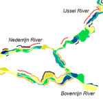
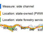
Supplementary material to the publication shows the river attributes, measure locations and effects for the 85 km reach of Waal River that was modelled (between the Pannerden bifurcation point and Gorinchem. All measures have the current main embankment (black outline) as their limit, except embankment relocation (G).
https://ars.els-cdn.com/content/image/1-s2.0-S1364815217307272-mmc1.pdf.
Related outputs
Biodiversity recovery following delta-wide measures for flood risk reduction
We show the biodiversity recovery from 15 years flood risk adaptation that consider nature requirements building a spatial extension to calculate biodiversity scores.
08/11/2017 by Menno Straatsma et al.
![]()
Contains: Dataset upon request Publication open access Storyline for practice
Low-hanging fruits in large-scale fluvial landscaping measures
We show that the multidimensional evaluation of river interventions in the Waal river opens up opportunities to discuss possible trade-offs.
19/09/2018 by Menno Straatsma et al.
![]()
Contains: Publication open access
Last modified: 24/01/2019