What would the Meuse look like today if our ancestors had not intervened over the last few centuries? The river would look very different for the Dutch part of its course.
Upstream, from its source in France to Liège, the river would flow at the same spot in the landscape as it does now. The river is stuck here in its own valley and on a time scale of hundreds of years – the time scale over which human interventions have influenced the river – this would not have changed.
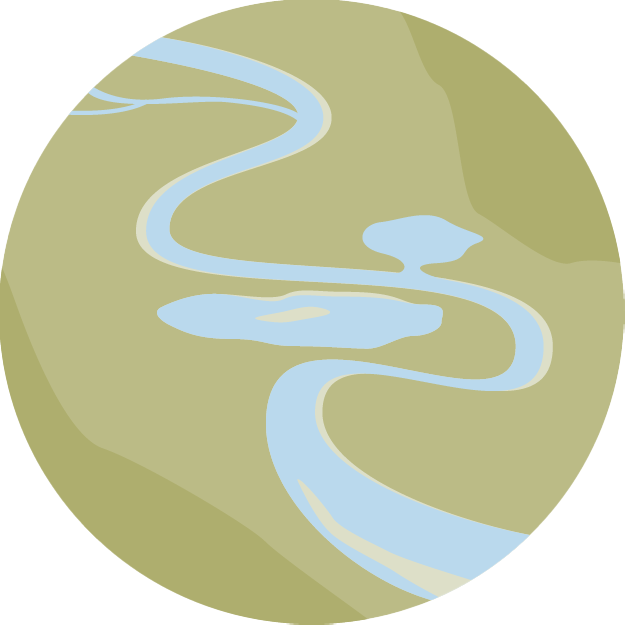
Downstream, in the Common Meuse section, the river would have approximately the same character as the gravel bed river we see today, gradually changing into a sand-bed river further downstream. The meandering river would occasionally – with an interval of tens to hundreds of years – cut off a meander bend or break through its banks and thus change its course in the landscape.
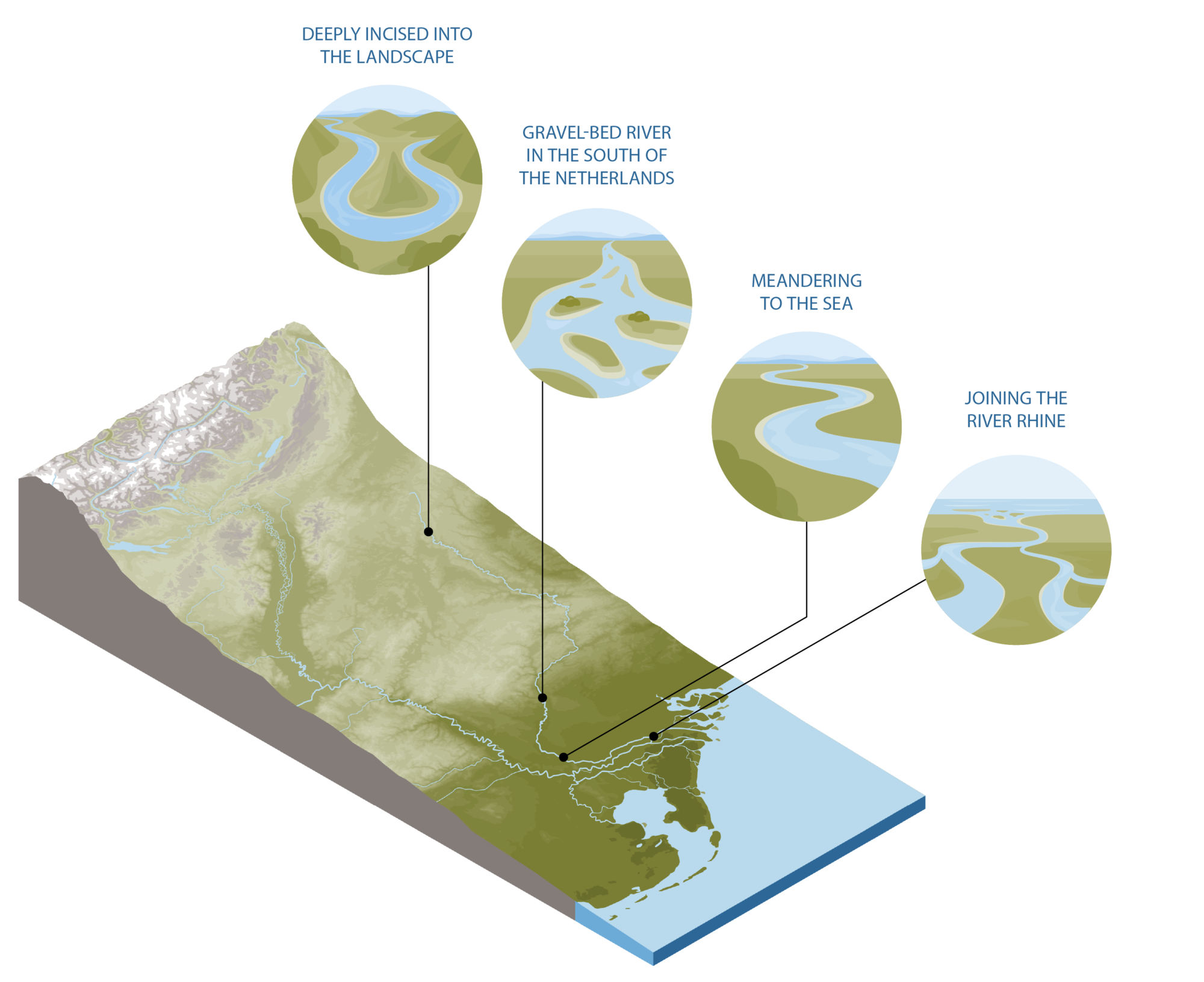
In the upstream reach deeply incised into the landscape
In northeastern France, the Meuse basin – from its source on the Langres plateau to Verdun – is remarkably narrow. Two hard rock mountain ridges on either side keep the river in place here. Further downstream – in the Ardennes – the river has incised deeply into the landscape while the old mountains, through which the Meuse flows, rose. In Limburg, this incision, in combination with the gradual shifting of the course of the river to the west, led to the creation of a series of Meuse terraces at different heights in the landscape. These terraces are a reminder of the location of the river at different spots in the landscape in the past, where the surrounding landscape of that time has since risen. The terraces are up to 150 m higher than the river; the oldest terrace is the highest. 31 terraces have been found, with an age ranging from 700,000 to several tens of thousands of years old.
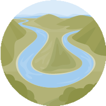
Gravel-bed river in the south of The Netherlands
Without human intervention, the Meuse would have looked different than it does today in the southern half of Limburg, from Borgharen to Thorn. This is the most natural part of the Meuse in the Netherlands. There are no dams, the water flows freely. But man has left his mark on the river over the centuries. Without human influences – the dikes and sheet piling on the Flemish and the riprap on the Dutch side of the river – the banks would be able to erode freely. The bed of the river would be less low than the incised bed of today, and the flood plains would be less high than the silted-up flood plains of today. Just like today, accelerations and decelerations of the flowing river water would constantly alternate over a river bed of gravel and sand. Without weirs in the river, at Borgharen and at many locations upstream, the variation of low and high discharges, and therefore of water depths and flow speeds, would be different than it is today. As a result, the variation in the size of the transport of sand and gravel, and thus the morphodynamics, would be greater than at present.
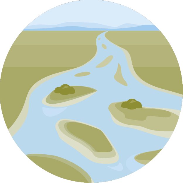
Meandering to the sea
In the northern half of Limburg, the river would change from a gravel-bed to a sand-bed river. The river would not yet be able to freely choose its course there. Fault lines in the earth’s crust mark raised parts – the horsts – and lowered parts – the grabens – which determine the location of the Meuse there. The grabens were the sedimentation zones for the coarse sediments transported by the river from the Ardennes, causing the thick gravel and sand packages to become increasingly thicker. Only in the north of Limburg is the river freed from these fault lines. Without human intervention, the river would continue to change its course here from time to time and flow to the sea via different routes.
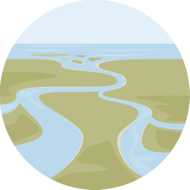
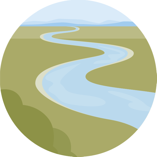
Joining the River Rhine
Downstream, the confluence of the rivers Rhine and Meuse would have looked different than it does today, without the dams of the Meuse – built between 1273 and 1904 – changing the river flow. The dynamics of sand and gravel transport would be much greater than today, and the bed of the river would be higher and the floodplains would be lower than today, which would allow for more exchange of water and sediment between the river and its floodplains. There would also be more connections between the Rhine and the Meuse.
Human intervention in the Netherlands has changed the discharge regime of the Meuse much more than that of the Rhine. This is mainly the result of the construction of seven weirs and locks, several canals that receive part of the discharge from the Meuse, and the interventions that ensure a separation of the discharge of the Rhine and the Meuse in the lower reaches up to their confluence at Rotterdam. The construction of the weirs in particular has significantly changed the sediment transport and morphodynamics. The Meuse is a rain-fed river. Rain in the Ardennes can lead to a discharge peak in the Meuse in Limburg a day later. If it does not rain for a long time, the Meuse sometimes drains almost no water. The Meuse therefore has an erratic discharge pattern and the differences between high and low discharges are large. At Liège the difference between the lowest and highest measured discharge is a factor of 150; for the Rhine that factor is ‘only’ 20. The weirs on the Dutch Meuse are closed five to ten days a year, from a discharge of 1100 m3/s (for the weir at Belfeld) to 1700 m3/s (for the weirs at Lith and Borgharen). The Meuse has eroded its riverbed on average by one to three meters over the past century, mainly due to human interventions in the system. On the one hand, the flow velocities in the river increased due to river narrowings and meander cut-offs. On the other hand, the sediment supply from upstream decreased, due to the settling of sediment behind the weirs in Wallonia and the Netherlands and in deep pools and deepened riverbed sections, and due to the riprap on the banks. The higher flow velocities lead to more erosion of the bed, which is not or hardly compensated by sedimentation as a result of the faltering sediment supply. In addition, in the past century, hundreds of thousands of cubic meters of sand and gravel have been removed from the river every year, causing the riverbed to sink and the erosion of the bed to increase because the plaster layer was broken during gravel extraction.
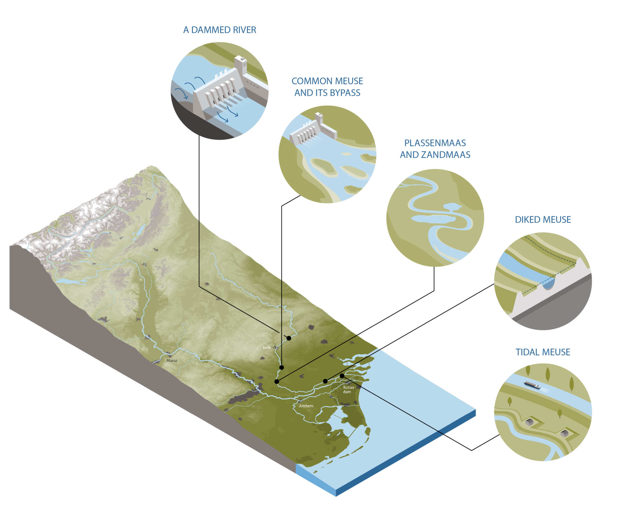
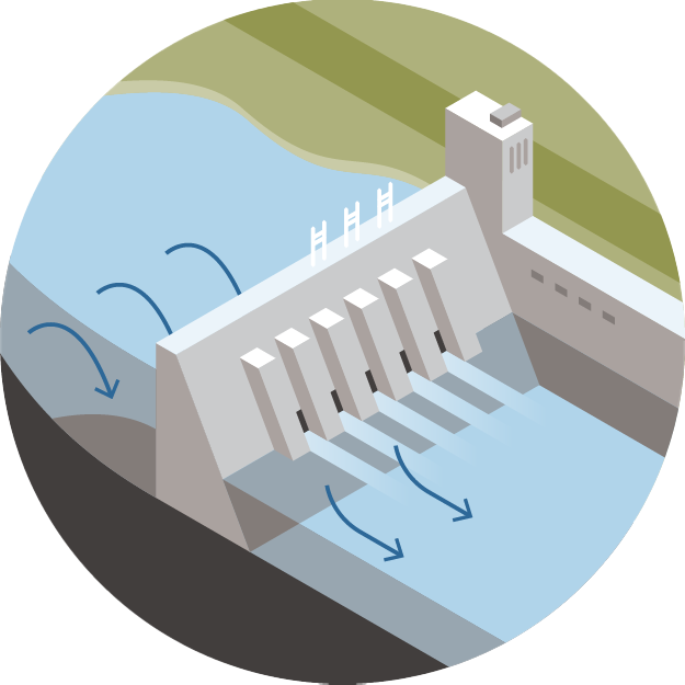
A dammed river from France to the Netherlands
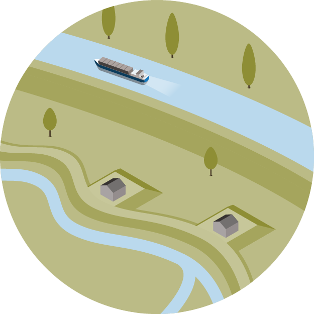
The original flood plain of the French Meuse, from before the settlement of people in this area, has been largely preserved to this day. The change from forest to cultivated land has not significantly changed the character of the river, but interventions have been made in the river itself that have influenced the flow of the water and the river course. The gradient of the river is regulated with low dams across the entire width of the river, which are bypassed by ships through constructed branches with locks. Meander bends have been cut off and parts of the river have been canalised, creating a shipping connection to Paris. In the Meuse in Belgium, weirs have been built in the river at 14 locations between the French and Dutch borders, as well as locks for shipping. As a result, the Meuse in this section has changed over time from a natural to a highly canalised river. At Liège, the Albert Canal is connected to the Meuse, connecting the ports of Liège and Antwerp. Also in the Netherlands, canals connect to the Meuse: the Zuid-Willemsvaart between Maastricht and Den Bosch, and the Juliana Canal between Maastricht and Maasbracht. These canals drain part of the Meuse discharge. The Meuse has also been partly dammed in the Netherlands. Weirs and locks were built at seven locations for shipping between 1915 and 1942.
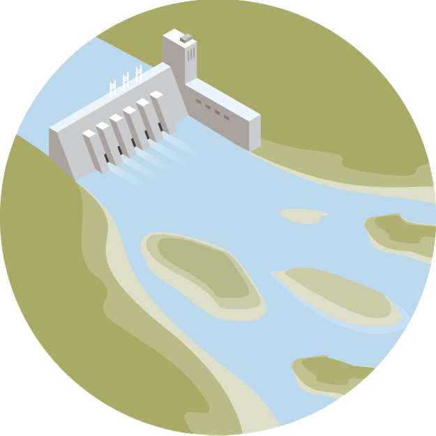
Common Meuse and its bypass
The Common Meuse is the border between Flanders and the Netherlands. Both countries work closely together on the management of this river. The Juliana Canal between Maastricht and Maasbracht runs parallel to the Common Meuse. Thanks to this canal, there is a shipping connection along the Meuse between France, Belgium and the Netherlands, while the natural character of the Common Meuse is more or less untouched. ‘More or less’, because due to the dammed nature of the Meuse in Belgium up to and including the weir at Borgharen, the discharge of the Common Meuse is no longer natural, and this influences the variation in the size of sand and gravel transports, and thus the morphodynamics of the river. But when the Meuse discharge is high, the Common Meuse is still a free-flowing, natural river with all the dynamics that go with it. There are rapids, gravel banks and wide flood plains. At low discharge, the water is almost stationary in some places, while at high discharge flow speed can be more than 5 m/s. On the Flemish side, the Common Meuse is completely diked, but on the Dutch side there are only dikes around the residential areas.
Plassenmaas and Zandmaas
From Thorn to Roermond, the Meuse flows in a graben. The riverbed has a noticeably gentler gradient here. As a result of the tectonic subsidence of this graben, the Meuse has deposited thick layers of coarse sand and gravel here in the past, some of which was excavated in the 1950s, leaving large pools of water in the landscape. Commercial shipping follows the Lateral Canal. There are two weirs in this section. Here too, only the residential areas are diked. The latter is also the case for the Zandmaas, which flows from Roermond to Cuijk. There are old river terraces here, up to tens of meters higher than the river. Here too, there are thick layers of gravel in the subsoil. There are two weirs in this section.
Diked Meuse
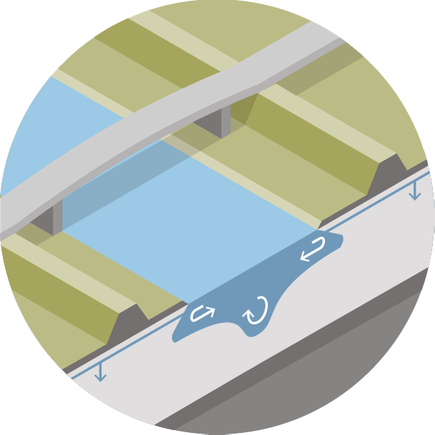
A large part of the Dutch Meuse is not diked, although there are dikes around residential areas. The Meuse is only completely diked downstream from Cuijk. There are also two weirs in the diked section, at Grave and Lith. The sediment of the river bed here is predominantly sandy. In recent centuries, the dikes have ensured that the sediment has been deposited on a relatively limited area of floodplains. As a result, the floodplains have become very high, meaning that the exchange of water and sediment between the river and its floodplains only takes place at very high discharges.
Tidal Meuse
The weir at Lith is the most downstream weir in the Meuse. From that point the river flows freely to its estuary. In the last part of the Tidal Meuse, the river flows through a dug section: the Bergsche Maas, completed in 1904. This dug section restored the drainage of the Meuse, which had been disrupted by the damming of the lower reach of the Meuse in 1273. After that damming, problems regularly occurred with the drainage of Meuse water. In the downstream section, several interventions have taken place in recent centuries that have changed the discharge of the river. For example, a connection between the Meuse and the Boven-Merwede – a branch of the River Rhine – was dammed when the Bergsche Maas was completed. Since 1273, this connection had played an important role in the discharge of the Meuse via the Boven-Merwede past Dordrecht to the sea. The Tidal Meuse is completely diked. The water of the Meuse mainly flows to the sea via the Hollands Diep and Haringvliet.
In addition to this erosion, the morphodynamics of the lower delta section are also characterised by large-scale deposition of sediments in more-or-less stagnant waters. There is a sand flux from the upper into the lower delta section, partly due to erosion of the bed in the upper delta section, and a flux of silt and clay coming from the German Rhine. The sand, silt and clay are deposited in the partly stagnant waters of the lower delta section.
Past interventions have greatly changed the morphological dynamics of the Meuse. These interventions, in particular the construction of weirs in the Dutch Meuse and upstream in Belgium and France, will continue to determine the future morphological dynamics of the Meuse. Climate change will also have an influence, due to higher peak discharges and longer periods of low river discharges. But the operational management of the weirs will also influence the change in the discharge regime, at lower discharges. Sea level rise will affect the river flow and the level of the river bed in the estuary part and further upstream. Rijkswaterstaat (Netherlands) has set up the Rivers2Morrow research program to focus on the likely consequences of human interventions and climate change for the sediment transport and morphology of the Rhine and Meuse in the Netherlands over the course of this century. For the Meuse, this program also focuses on measures that will be carried out in relation to the Water Framework Directive to improve the ecological quality of the river. These measures are interventions in the river morphology that create more habitat for fish species that are now under pressure.
Rijkswaterstaat (The Netherlands) has established the research programme Rivers2Morrow to focus on the likely impact of these developments on sediment transport and morphology of the lower reaches of the Rhine River in the course of this century. It aims to increase the knowledge of the functioning of lowland rivers in the field of hydraulics and morphology. The programme started in 2018 and will run to 2024.
Morphodynamics of supply limited rivers with weirs: case study of the River Meuse
Improved knowledge on the sediment balance of the Meuse River and on how to model sediment transport and morphology for the next century helps to plan sustainable river measures.
Most rivers are supply limited, meaning that the sediment load to the river channel is less than what can be transported by the flow. Together with other causes – like river straightening, narrowing and dredging – this causes ongoing riverbed erosion. To mitigate problems related to ongoing erosion, better knowledge on the sediment balance of the river and long-term impact of measures is required. This research project focuses on understanding the sediment balance of the Meuse River over the last 25 years, and modelling sediment transport and morphological changes with analytical techniques. Results on analytical modelling may allow us to simplify equations on sediment transport and morphodynamics so we can use faster numerical morphological models for long-term simulations.
These numerical models are required to assess the impact of past and future measures on riverbed development and water levels. As morphological changes are generally slow, simulations for the next century are required to design no-regret river interventions. It is essential to include uncertainties in these simulations.
One significant development in recent decades has been the decrease in the annual amount of fine sediments that the Rhine transports from Germany into the Netherlands. This will have an effect on river management. If we can understand what determines the decreasing silt concentrations in the Rhine, we can also estimate how that trend will develop in the future.
Research into the supply and origin of fine sediments in the Rhine focuses on finding answers to why the fine sediment concentration in the water has decreased in recent years and what the future trend will be. The results of this research will help policy makers to project future changes in the water quality of the Rhine and Meuse, and to formulate the best policy in response. This is particularly important because fine sediments carry pollutants due to their cohesive properties. For river managers, on the other hand, this research theme is important because it will help them to project future changes in dredging volumes in the lower reaches of their rivers.
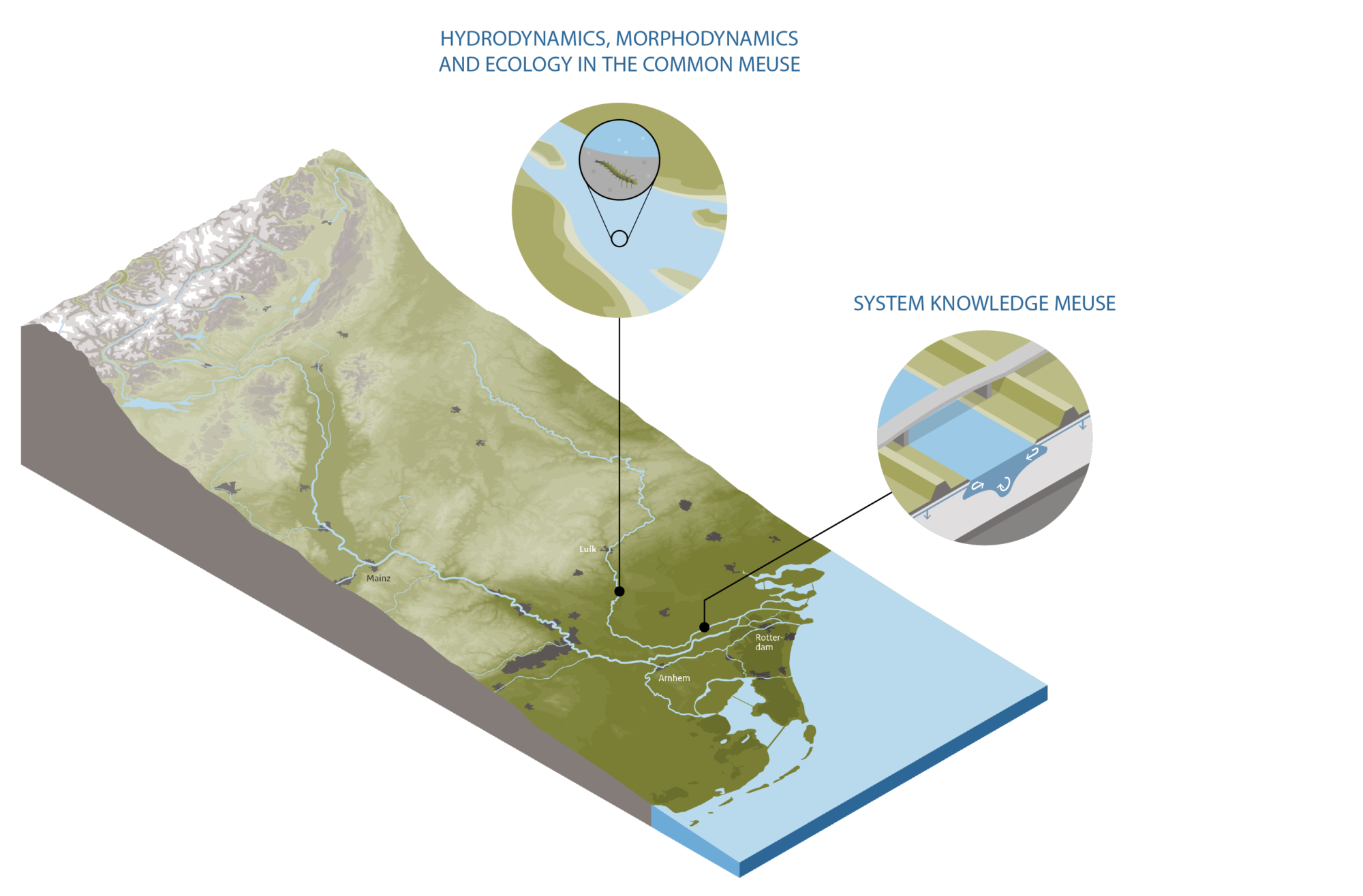
Hydrodynamics, morphodynamics and ecology in the Common Meuse
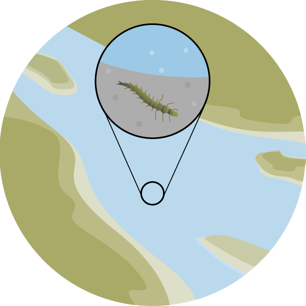
The sediment composition of the bed of the Common Meuse influences the aquatic communities in the river. This composition is strongly influenced by weirs in the river basin, by river widening projects, and by gravel extraction. Not only do the contributions of sand and gravel to the bed change, for example due to the erosion of a top layer of coarse gravel at high discharge. Mud also periodically settles on the river bed, changing the properties of the bed that are relevant to organisms – such as the pore space and permeability of the bed material. These changes can, for example, reduce the oxygen content in the bed, thereby reducing the habitat suitability for organisms. The research addresses aquatic ecology with a special focus on the role of morphodynamics. Two PhD students will carry out the research. They study the properties of the bed and the factors that influence them, and how these properties can limit the development of a favourable state of the aquatic macroinvertebrate community. Central are impacts of human actions and autonomous developments on the living environment and the occurrence of animal species that depend on the properties of the riverbed. The impact of morphodynamics refers to the spatial and temporal variation in the composition of the bed sediment, and the factors that determine this variation. This research aims to increase our understanding of how the disturbed morphological dynamics and the impact of management measures influence the habitat quality for species in the Common Meuse via the properties of the bed. The results of this research will improve the river manager’s control over the factors that are most limiting for the occurrence of aquatic communities in the river. This allows the river manager – in the long term – to reduce or remove these obstacles, for example through the design of gravel nourishments or by adjusting the dynamics of water flow and sediment movement.
The height and strength of the dikes along the Dutch Rhine branches are designed according to specific assumptions about discharge partitioning among the branches at times of extremely high discharge. If these assumptions no longer hold true, a shift in the discharge distribution may well have implications for flood protection. A shift may also affect fresh water supply downstream in times of drought when it is required to combat salt intrusion in the outlet at Rotterdam and to ensure a sufficient fresh water supply in lakes that are reservoirs for agriculture and drinking water. Finally, a shift may affect the navigability of the Waal and IJssel branches at times of low discharge.
Research into the morphodynamics of river bifurcations provides insight into the distribution of water and sediment at the Rhine bifurcations, and explores how human actions, sea level rise and a changing discharge regime influence this. A good understanding of the variability in the discharge distribution at river bifurcations is relevant for all main river functions, and hence for all policy areas that serve these functions, including flood protection, shipping at low discharge, fresh water supply (including combatting salt intrusion), nature and groundwater levels, and water quality. Three ‘water taps’ more-or-less control the water distribution in the Dutch delta: a weir in the Nederrijn branch at Driel, locks in theHaringvlietdam to the south of Rotterdam, and locks in the Afsluitdijk to the north of lake IJsselmeer. This control is also affected by any changes to the riverbed levels of the various branches near the bifurcations.
Last modified: 27/12/2023