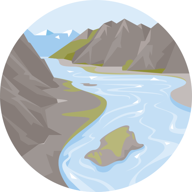
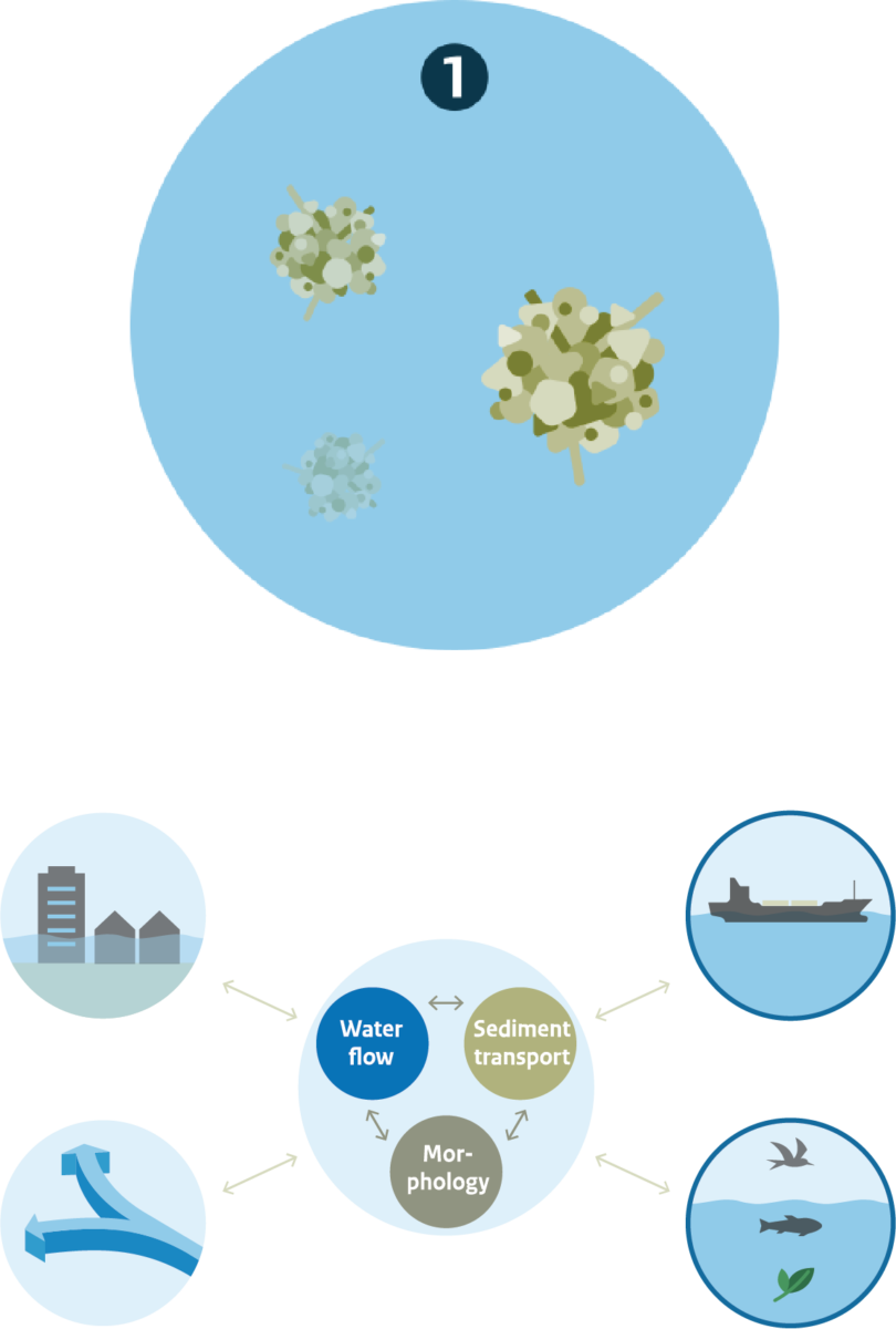
What would the Rhine look like today if our ancestors had not intervened over the last few centuries? To answer this question, we can create an impression of the river’s natural dynamics by taking the pattern of multiple channels and islands in 1700, and by leaving out the dikes and other human interventions. We can then extrapolate from this to arrive at a model of the natural dynamics as they would appear today.

Upstream, in the Alps, the river system would look quite similar to the current situation, with small mountain streams joining larger ones. However, there would be much more variation in the amount of discharge given the absence of dams which control water and sediment flow. This would have resulted in greater variation in the amount of sediment transported downstream, creating a dynamic system of deposition and erosion. Sand and gravel would form islands and bars around which the branches of the river would flow, changing their courses time and again in a process known as ‘braiding’.
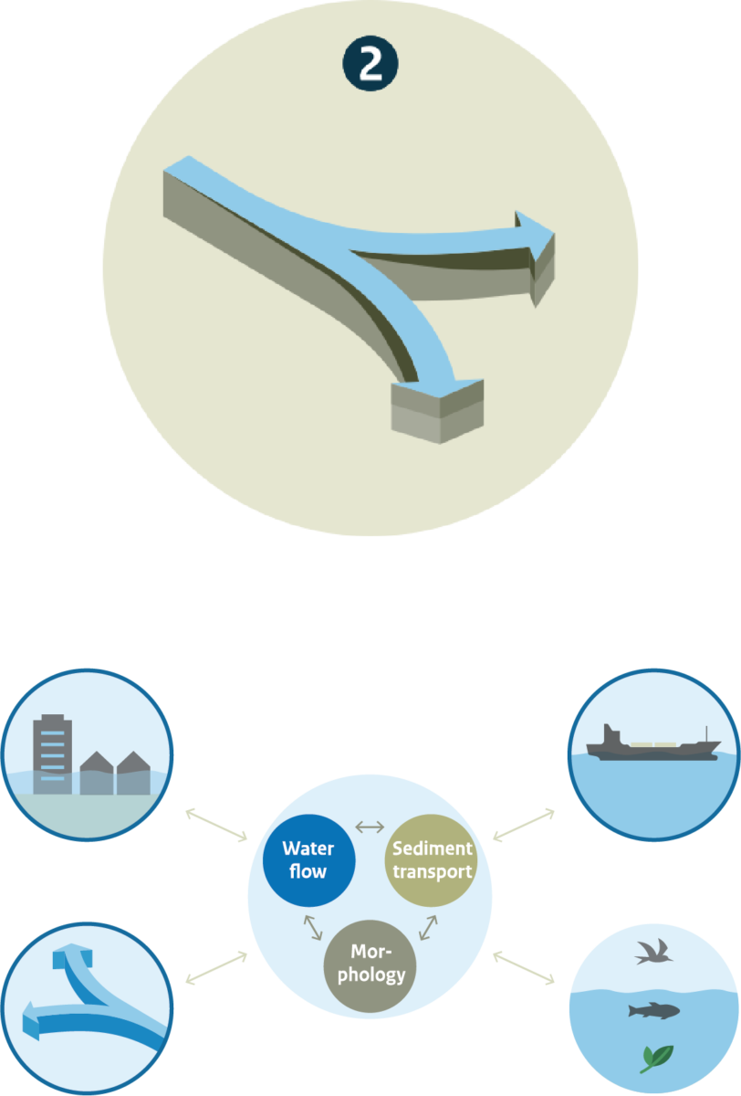
Downstream, the natural river would gradually have changed from braiding to meandering, as it does today. But this river would have developed several channels, again dividing and converging around stable islands of sand and gravel albeit less dynamic than those of the braided reaches, representing a process known as ‘anabranching’. After several centuries, a given branch would burst its banks and find a new course to the sea causing the branches to spread out into a deltaic plain and flow into the North Sea at several points.
River dynamics at the source
The source of the Rhine River is in the Swiss Alps. Two headwater streams, the Vorderrhein and the Hinterrhein, combine to form the Alpenrhein. This flows into Lake Constance where it drops its sediments. The gravel settles first, building a small delta that protrudes into the lake. The sand, silts and clay settle further down the lake.
The headwater streams and the Alpenrhein are fed by melting snow with the maximum discharge usually occurring in the spring. However, the amount of sand and gravel carried by the streams varies greatly in time and space. Volumes may be particularly high at times when large amounts of sand, gravel and rock slip into the streams from the mountain sides, yet it may take years for these sediments to be transported further downstream. When sediment supply is greater than the river flow can handle, river branches may become blocked and the water forced to change its course. Such a braiding process is particularly severe at times of flood.

Lake Constance: natural sediment trap
While continuity of sediment transport along a river’s course is characteristic of natural rivers, this is not true for the Rhine. Upstream, its course is interrupted when the Alphenrhein catchment flows into Lake Constance. It then flows out of the lake near the city of Constance. In effect, the lake cuts the river basin in two.
When the river enters Lake Constance, the flow velocity of the water is interrupted and the sediment it carries is dropped. At the outflow of the lake, however, the river begins to build up its sediment load again. The net effect of this is that Lake Constance disconnects sediment transport in the Alpenrhein from the lower parts of the river, making the source zone in the Alps largely irrelevant for sediment transport and morphodynamics in the Rhine downstream of Lake Constance.
River dynamics in the transition zone
Downstream of Lake Constance, the Rhine flows through a landscape of hills and low mountains. Without human intervention, the river would have been a few kilometres wide, containing many separate channels and islands. Such a pattern of channels is less chaotic than a braiding river, yet not as calm and stable as a meandering one.
In the transition zone between the mountains and the delta, the natural dynamics of the Rhine do not change much. The river starts anew at Lake Constance, and is cut off from the highly variable discharge regime and gravel fluxes in the Alpine section. Without the presence of Lake Constance, the highly variable discharge and gravel fluxes would have favoured a braiding character in the upstream part of the transition zone.
Delta dynamics
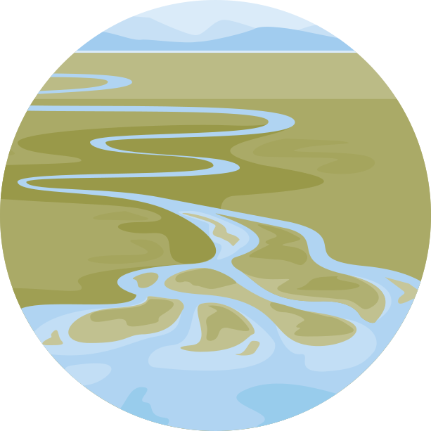
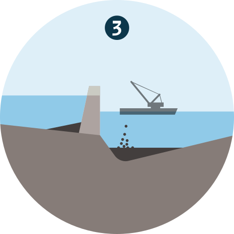
Without human intervention, the branches of the Rhine would be a few kilometres wide. Each branch would be made up of a few meandering channels, dividing and converging around islands of mostly sand. At times of very high discharge, the water would flow over the natural levees to flood large parts of the country. Sand would settle close to the river, while silts and clay would settle in much of the lower terrain. Such a process would have continued to build the deltaic plan of the Netherlands. At other times of the year, the branches in the natural, undisturbed river delta would only carry water in part of their course, and, in dry summers and autumns, most of the riverbed would be dry.
The course of the river exposes the subsoil it travels over. A subsoil of mostly sand is revealed by large meanders, and by oxbow lakes formed where earlier meanders have been cut-off from the river; such subsoil is conducive to meander formation. A subsoil of peat or clayey deposits is revealed by straighter stretches of the river reaches; such subsoil hinders the formation of meanders.
At a number of spots along the sandy coastline there are estuaries where river and seawater mix, and a rich biodiversity flourishes along the saline gradient from river outflow to the sea.
Human intervention has changed the discharge regime of the Rhine throughout its length – from its headwater streams in the mountains to the outflow into the North Sea. As a result, sediment transport and morphodynamics have also changed.
The first direct human interventions go back a millennium, with the start of the embankment. Indirectly, human influences go back thousands of years, with deforestation and land use change in large parts of the river catchment. More recently, major interventions began at around 1700.

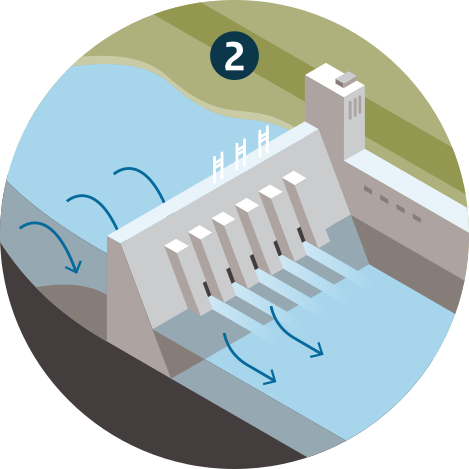
An alpine section where dams control river discharge and sediments are trapped in reservoirs and Lake Constance.
The presence of many dams in the upstream reaches of the Alpenrhein catchment has changed the discharge regime of the headwater streams and the Alpenrhein. River flow is still dominated by snowmelt, and maximum discharge is still in spring, but high and low discharge extremes are less extreme now compared with the situation before dam construction. Runoff is distributed more regularly over the year. At times, large volumes of sand, gravel and rock still slide from the mountains into the streams, but in many streams dams prohibit the transport of these sediments further downstream.
Because the dams have disturbed the continuity of sediment transport, sediment management has become necessary. This involves the removal of sediments from where they block streams, and the artificial supply of sediment material downstream of dams; the latter is done to counteract bed erosion, for dams block the natural sediment flow from upstream. In addition, gravel mining in the Alpenrhein has eroded the riverbed in several places; mining began in the 1940s, came to a head in the 1960s, but has been cut back significantly since 1970. Nevertheless bed erosion can still be found along some of the Alpenrhein and bed stabilization measures are taken to stop erosion. Elsewhere, gravel and sands are deposited and dredging is needed to control flood risk.
An impounded section just downstream of this lake where dams prohibit continuous transport of gravel and coarse sands.
The outflow at Lake Constance forms the beginning of the impounded river section, a 310 km long stretch regulated by 21 dams. Built between 1898 and 1977, the dams were established to regulate discharge and to allow hydropower generation. The net effect of the impounded section is to create a man‐made extension of the natural sediment trap formed by Lake Constance.
Before dam construction, the sediment load of the Rhine downstream of the Alpine section used to rebuild starting from the outflow at Constance. Now, for the coarse sediment fraction, this point is located at the Iffezheim dam more than 300 km further downstream. Due to the dams there is no continuity of gravel transport in this part of the Rhine. Probably only fine sand, silt and clay pass the dams.
A free-flowing section that covers most of the Rhine in Germany.
Only the finest sediments are transported into the free‐flowing section. These sediments have little effect on this section’s river morphology as most remains suspended in water until deposited in the more-or-less stagnant waters of the delta. The impounded section stops coarse‐grained sediment from entering the free‐flowing section. Because of this, specific measures are necessary to prevent parts of the riverbed from eroding.
Riverbed erosion begins immediately downstream of the impounded section and so the riverbed must be stabilized. At Iffezheim, 166,000m3 of gravel a year has been added to the river downstream of the dam since 1978 to prevent further channel degradation.
An upper delta section where the river divides into several branches.
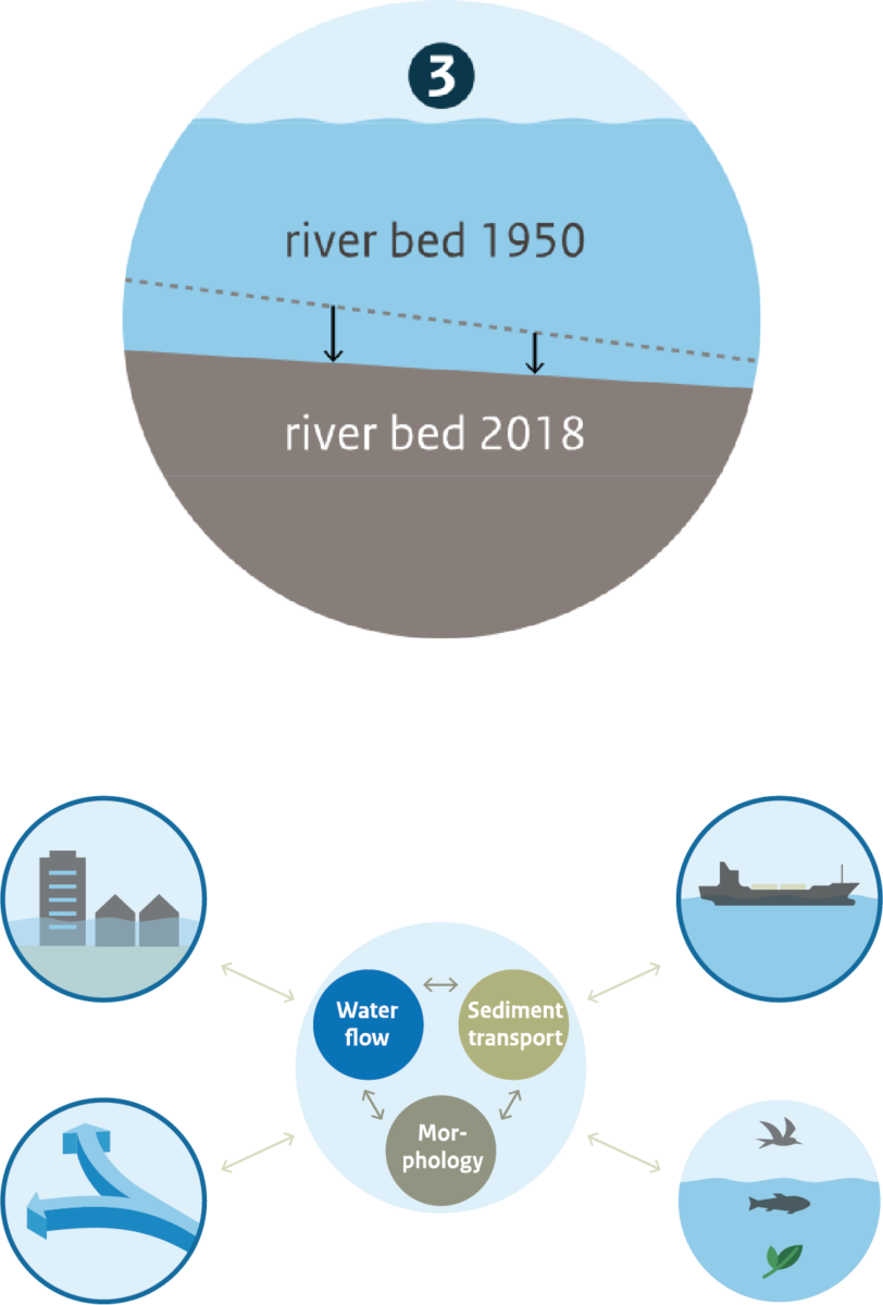
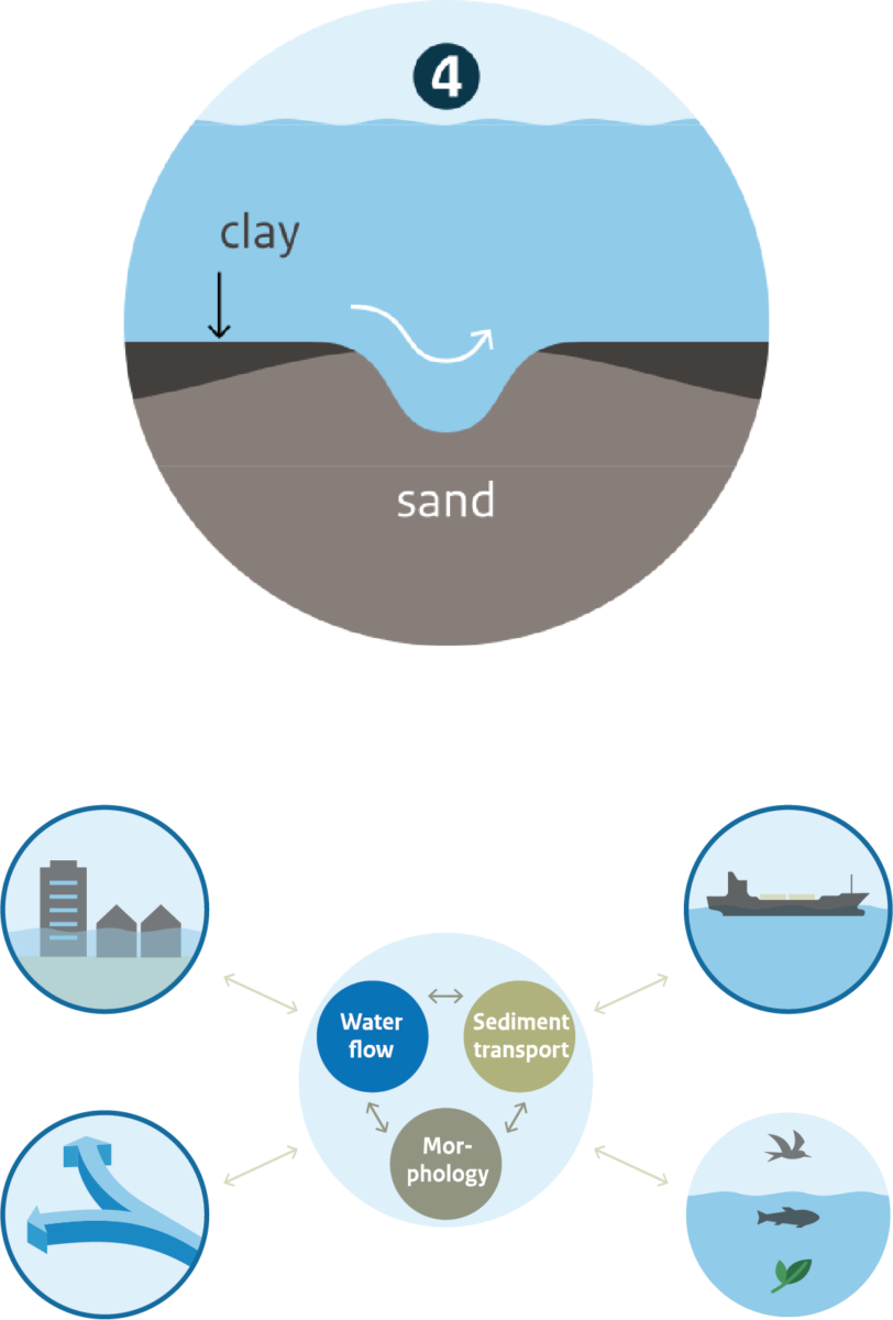
The riverbed of the free‐flowing section has been eroding for decades. While the eroded material mainly consists of sand, gravel tends to accumulate and thus there is a coarsening of the riverbed. This is observed all along the free‐flowing section and into the delta section. As less sand is transported into the upper delta, and a shift to a coarser composition of the sediment input takes place, it is likely that this will affect bed degradation and change river bed morphology in the coming decades.
The riverbed of the upper delta section has been eroding for more than a century in response to human intervention, including large-scale dredging. This erosion is still ongoing albeit at a slower rate than in the 20th century, and in the Dutch Bovenrijn, near the border with Germany, the erosion seems to have stopped. Riverbed degradation will continue to be affected by past, present and future interventions, by changes in the sediment load coming from upstream, and probably by the effects of climate change.
The floodplains along these rivers exhibit little in the way of morphodynamics. They have accreted to such a high level that they are rarely flooded and sedimentation is now very low, although fine sediments still settle onto the floodplains every now and then. Most of the silt and clay from the German Rhine passes the upper delta, and settles in the lower delta.
A lower delta section where silts and clay settle, and tidal currents also influence sediment transport and morphology.
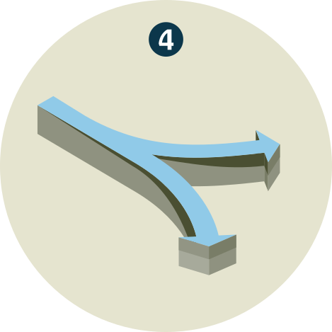
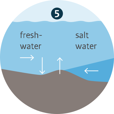
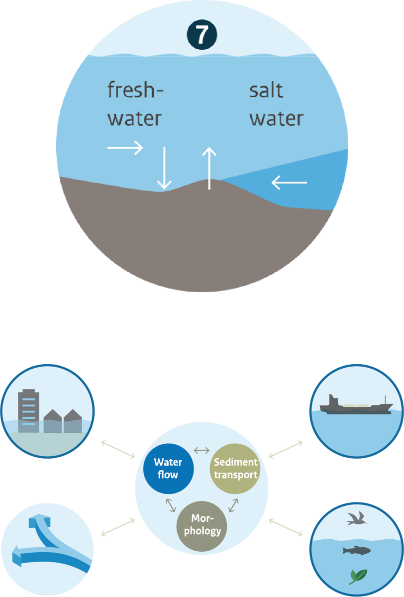
The hydrodynamics of the lower delta section near Rotterdam is complex. The combined discharge of multiple rivers flows into the North Sea at two outlets. The one to the south, Haringvliet, is almost fully closed by a dam most of the time; the sluices in this dam are only fully open when the river discharge is high and the tide low. The one to the north, Nieuwe Waterweg, is the open outlet of the rivers Meuse and Rhine. The two outlets are connected by smaller rivers flowing north‐south. Because the tide only enters this area through the northern outlet, the difference in water level between the northern and southern outlet is large. As a result, strong currents develop in the connecting river branches that create erosion pits in the beds. More than 100 of such erosion pits have already developed.
In addition to this erosion, the morphodynamics of the lower delta section are also characterised by large-scale deposition of sediments in more-or-less stagnant waters. There is a sand flux from the upper into the lower delta section, partly due to erosion of the bed in the upper delta section, and a flux of silt and clay coming from the German Rhine. The sand, silt and clay are deposited in the partly stagnant waters of the lower delta section.
The future morphodynamics of the Rhine will be driven by a combination of past interventions to which the river is still responding, by future interventions and by climate change. In the course of the current century, peak river discharge will probably increase; low river discharge will decrease and last longer in summer and autumn. Sea level rise will affect river flow and bed level changes in the delta sections and further upstream.
Rijkswaterstaat (The Netherlands) has established the research programme Rivers2Morrow to focus on the likely impact of these developments on sediment transport and morphology of the lower reaches of the Rhine River in the course of this century. It aims to increase the knowledge of the functioning of lowland rivers in the field of hydraulics and morphology. The programme started in 2018 and will run to 2024.

The supply of fine sediment from the Rhine basin
Fine sediments dominate the sediment budget of the lower reaches of the Rhine. In the past several decades, about three-quarters of the sediment flow entering the Dutch Rhine was silt, the remainder being sand and gravel. At higher discharges, some of these sediments settle on the floodplains and in the secondary channels. Most of the time, however, these sediments settle in the Rotterdam harbour basins and in more-or-less stagnant waters of the lower delta section.
One significant development in recent decades has been the decrease in the annual amount of fine sediments that the Rhine transports from Germany into the Netherlands. This will have an effect on river management. If we can understand what determines the decreasing silt concentrations in the Rhine, we can also estimate how that trend will develop in the future.
Research into the supply and origin of fine sediments in the Rhine focuses on finding answers to why the fine sediment concentration in the water has decreased in recent years and what the future trend will be. The results of this research will help policy makers to project future changes in the water quality of the Rhine and Meuse, and to formulate the best policy in response. This is particularly important because fine sediments carry pollutants due to their cohesive properties. For river managers, on the other hand, this research theme is important because it will help them to project future changes in dredging volumes in the lower reaches of their rivers.
The stability of river bifurcations in the delta section
In a densely populated country such as the Netherlands, it is vital to be able to control the distribution of river discharge and sediment flow in the river branches, and the authorities have attended to this since 1707. The situation is complex. Changes in hydrodynamics and sediment transport may lead to changes in the morphology of river bifurcations that in turn also change the discharge distribution. For instance, a lowering of the bed level of one of the two branches will increase discharge through this branch at the expense of the other.
The height and strength of the dikes along the Dutch Rhine branches are designed according to specific assumptions about discharge partitioning among the branches at times of extremely high discharge. If these assumptions no longer hold true, a shift in the discharge distribution may well have implications for flood protection. A shift may also affect fresh water supply downstream in times of drought when it is required to combat salt intrusion in the outlet at Rotterdam and to ensure a sufficient fresh water supply in lakes that are reservoirs for agriculture and drinking water. Finally, a shift may affect the navigability of the Waal and IJssel branches at times of low discharge.
Research into the morphodynamics of river bifurcations provides insight into the distribution of water and sediment at the Rhine bifurcations, and explores how human actions, sea level rise and a changing discharge regime influence this. A good understanding of the variability in the discharge distribution at river bifurcations is relevant for all main river functions, and hence for all policy areas that serve these functions, including flood protection, shipping at low discharge, fresh water supply (including combatting salt intrusion), nature and groundwater levels, and water quality. Three ‘water taps’ more-or-less control the water distribution in the Dutch delta: a weir in the Nederrijn branch at Driel, locks in theHaringvlietdam to the south of Rotterdam, and locks in the Afsluitdijk to the north of lake IJsselmeer. This control is also affected by any changes to the riverbed levels of the various branches near the bifurcations.
The effects of climate change and sea level rise on bed level elevation of the Dutch Rhine branches
The long-term incision of the riverbed of the branches in the upper delta has many adverse effects. For instance, shallows will be created around any man-made obstacles on the bed as the rest of the bed erodes away, causing problems for shipping. In addition, flood protection and fresh water supply will be disrupted by a difference in incision rates between branches which affects discharge distribution. Finally, the natural environment will suffer from falling groundwater levels at times of low discharge, and from a reduction in the frequency of floodplain inundation.
Incision is caused by a combination of human interventions. The rivers were narrowed two centuries ago by straightening and normalization work. This initiated an incision of the rivers, a morphological response that set the rivers on a course to a new equilibrium with a lower elevation of the bed. The large amount of sand and gravel that was removed from the rivers in the first half of the last century was partly intended to establish a new bed elevation equilibrium more quickly.
Major interventions in the rivers were also carried out in the second half of the last century. Meander cut-offs shortened the length of the IJssel, increasing its slope and accelerating the erosion of the riverbed. The construction of weirs in the Nederrijn-Lek has greatly reduced the continuity of sand and gravel transport there, which has in turn accelerated the erosion of the bed downstream. More recently, the measures taken at the beginning of the current century under the ‘Room for the River’ programme have scattered local effects on this large-scale incision that, depending on the type of measure, have led to erosion in one place and sedimentation in another.
How the riverbed elevation will develop in the future depends on the combined effect of such interventions, together with developments across the border and climate change. The long-term morphological effects of the Room for the River programme are still being studied, involving the monitoring and measuring of changes throughout the system.
Thanks to a good understanding of riverbed dynamics of the Rhine branches in the upper delta section, we will be able to project how the riverbed will develop in response to past interventions and to future sea level rise and changing discharge regime. Once we know how these contribute to bed development, we can intervene in the driving forces and bend the trend to a desirable riverbed elevation. This way, the main question from policy and management can be addressed: What is the desirable river bed elevation, in view of the different river functions, and how can it be achieved?
The effects of climate change and sea level rise on the morphology of the Rhine-Meuse estuary
Erosion of the riverbed in the lower reaches mainly occurs locally, with deep erosion pits in a number of branches. These pits threaten the stability of banks, structures, and cables and pipelines. Hence river management is needed to halt or at least limit their development, in addition to tackling other important issues such as salt intrusion.
Riverbed dynamics in the lower delta section are determined by the behaviour of sand and mud (the latter composed of silt and clay). In this section of the river, these materials move as a relatively undifferentiated mixture, whereby the adhesive properties of mud flocks prevent sand from obeying transport formulas that apply upstream; consequently, physical research is required to devise new formulas which can be built into models. A complicating factor occurs when river water mixes with saline water: the salt reinforces the adhesion of the mud particles and this changes the behaviour of the sand-mud mixtures.
Erosion of the riverbed not only occurs in the upper reaches, but also in the lower delta section. The underlying processes and the scale of the erosion are different, however. In the lower reaches, the erosion mainly occurs locally, with deep erosion pits in a number of branches. The main driving processes behind the erosion are related to the Delta Works. Because bed sediments in this section are mixtures of sand and silt, the behavior of such mixtures must be incorporated into the formulas and models that are used to explore the dynamics of the river bed. As numerical models improve, policy makers and river managers will be better equipped to ensure a stable river bed for the entire area and to combat local erosion.

Improved quantification of sediment transport
While researchers need data on water flow, sediment flow, and morphological developments to understand the processes in the river and to calibrate and validate formulas and models, data is also required by policy and river management. Monitoring and evaluation are important parts of the policy cycle to track whether policy leads to the results that were intended, or whether adjustments are needed. The river manager needs data to take the right decisions. Bed elevation surveys, for instance, are needed to decide where to dredge and where to dump the dredged material.
The strength of a good data set lies in the optimal combination of different measuring techniques, each of which can best detect a certain parameter, together with a smart interpretation of the data collected. Acoustics, for example, can be used to calculate both the sand concentration in the water and the flow rate of that water by interpreting the same signals differently. Measurements of bedforms can also be translated into values for bed roughness and, by tracking the migration of bedforms, a measure of the sand transport over the bed can be derived.
The lower delta section is a sediment trap for sediments coming from both the various river branches and from the sea; consequently, it needs to be managed to safeguard navigation, ecology, bed stability and flood safety. Policy makers and river managers need to consider the range of possibilities for long-term sediment management in this area, and to assess them based on a thorough understanding of the sediment budget of the lower delta section. This calls for insight into trends in the amount of sediment present in the lower branches, whether it be deposited by the rivers and the sea, added to by dumping, removed by dredging or eroded by the action of water.

The dynamics of bed forms
The riverbed is not flat. As river discharge increases, the water that flows over the riverbed creates bedforms that cause the water level to rise. Such bedforms can develop into high dunes when river discharge is especially high, with the effect that the water level is pushed higher than it would otherwise be. Once the flood wave has passed, the bedform flattens again; however, this takes time and when the water level drops quickly, shallows can present obstacles to shipping.
The dynamics of such bedforms on the riverbed are relevant for flood protection and low water policy. They may contribute to extremely high water levels in the Rhine branches, but it is not clear whether the dunes survive extremely high discharges . If we understand this influence, we can calculate the high water levels required to set the height and strength of river dikes, and we can identify the formation of shallows after flood waves have passed to determine the need for any additional dredging.
The safety standards for Dutch river dikes are strict, intended to guarantee a very high level of flood protection. The dynamics of bedforms on the riverbed are relevant for these safety standards since they may increase the roughness of the bed, slowing down water flow and causing the water level to rise. This effect would be significant under high discharge conditions, but there has been little research on this. The research theme will fill this gap and provide the information needed by policy makers and river managers. Researchers will gain insight into the rate at which bedforms rise and fall, the nature of the roughness, and the effect on water flow and peak water levels.
Once the water level drops after the flood wave has passed, the bedforms disappear and the riverbed flattens again. However, there is often a time lag between the dropping water level and the flattening of the bed. Where bedforms linger, therefore, they can create shallows that threaten shipping and that require subsequent dredging. Knowledge about the growth and decay of bedforms is therefore not only relevant for flood protection, but for maintenance of shipping lanes as well.
Sediment dynamics in the Rhine-Meuse estuary
The budget of sand and silt in the lower delta section is the result of the convergence of many processes. Factors include the supply of sand and silt from the rivers and the sea, the mixing of fresh and salt water, changes in the discharge regime of rivers, sea level rise, and dredging and dumping. The impact of these processes on the budget of sand and silt must be thoroughly understood in order to be able to draw up scenarios for morphological developments in this area, for instance in relation to climate change.
A sediment budget is an important tool for river managers. In particular, it allows for effective sediment management when developing a smart strategy for dredging and dumping so that the riverbed is kept as stable as possible.
If sediment supply changes due to climate change and human intervention, to what extent is our current policy sustainable? With this question in mind, policy makers are looking at data on sediment flows in the Rhine river system. However, they need to know whether they can rely on the data. It becomes relevant, for example, to know whether changes in sediment flows from one year to another are a sign of changes in the river system or merely due to a lack of sufficient high quality, sensitive data to measure and quantify sediment transport. Studies in the past have shown that the data-generation techniques are far from perfect. In this research theme, therefore, researchers will improve the techniques by studying the latest innovations in the quantification of sediment flows. They will present policy makers and river managers with the best possible quantification of sediment transport by combining different measuring techniques and smart methods for data processing.
Last modified: 27/12/2023