

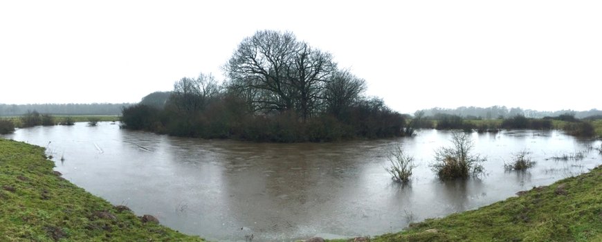
The photo shows the old river course that still remains in the Overijsselse Vecht valley. Courtesy from Jasper Candel and Cindy Quik from the news item that they published in Natura today (In Dutch)
This is an English version of the article that was originally published by Nature Today in Dutch.
More and more rivers and streams in the Netherlands are being widened again. However, rivers are very changeable as soon as we remove all bank protection and embankments. Rivers can migrate very actively or do not travel at all. Jasper Candel and Cindy Quik, Ph.D. researchers at the Wageningen University & Research looked into the past to understand: How and where do river bends, for example, arise when you remove the bank protection?

Overijsselse Vecht in the year 1851 (Source: CC-BY Kadaster, 2018)
The river Overijsselse Vecht was canalized at the beginning of the last century. However, this river in the past had a very strong meander due to a shift in its bank of about two to three meters per year (see photo). Jasper and Cindy estimated the age of this meander by looking at historical maps and dating with an innovative technique (optically luminescence dating) the last time that the deposited sand saw the sunlight. Their published results show that the meander is from the Middle Ages but the river itself is much older.
Before the Middle Ages, the Overijsselse Vecht was indeed a very stable river that hardly changed. By looking at the thickness of river deposits, researchers made a rough estimation of the amount of water that used to flow through the river before and after the meander formation. It turns out that from the Middle Ages high water discharges were a factor of 3 to 12 higher than before. This increase in high water is very likely due to two changes: climate change and landscape changes.
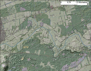
Overijsselse Vecht in the current situation (Source: AHN (2018); Van Heerd et al. (2000); OpenTopo, Van Aalst (2017))
The researchers’ show with their studies that high-water discharges during this period were much higher than now, due to ice blockades in the rivers that regularly break through and because of high snow-melting. In addition, the catchment area of the Overijsselse Vecht consisted for about 27% of peat. Peat functions as a sponge and can retain a lot of water during intensive precipitation so that the high water discharges in a river are very limited. The landscape changes from the 14th to the 17th century due to reclamations for agriculture and excavations for peat extraction led the sponge to disappear, and flood discharges in the river increased significantly.
Digging into the subsurface is indeed like reading a history book. History can provide insight into how rivers used to function and how they might do so again. This is how the history of this meander confirms that the redevelopment of the stream and river valleys requires a catchment area approach, which takes into account increasing flood discharge due to climate change or urbanization.
Related outputs
Change from a laterally stable to meandering river – a reconstruction of the historical discharge
We show how the Overijsselse Vecht river changed from a laterally stable to a meandering river ca. 500 years ago and further developed a methodology to reconstruct the historical discharge.
31/08/2018 by Jasper Candel et al.
![]()
Contains: Dataset access Publication open access
Last modified: 13/12/2019