

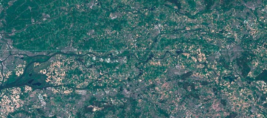
A river section along the River Waal in the Netherlands between Millingen and Gorinchem covering 100 km and imagery available from 2012–2017. (Source: Google Earth Engine).
Innovative components
We propose a method to quickly detect where floodplain vegetation changes occur and to which vegetation class did they change. We take advantage of frequent and open remote-sensing data that is available on the Google Earth Engine, such as Landsat, Sentinel, airborne imagery and surface models. Traditional multi-temporal classification based on a pixel value threshold is problematic due to the small (e.g. spectral) differences in vegetation. Instead, we compare vegetation attributes with specific classes at a given moment and detect outliers. If we identified the vegetation attributes as outlier multiple times, we considered them as changed.
Findings and implications for practice
The method is tested in a section of the floodplains along the Dutch river Waal (see Figure above). A classified vegetation polygon map based on high-resolution airborne imagery from 2008 is used to extract the reference values to analyze the multisensor and multitemporal data. Land-cover changes of natural forest, grassland, and arable fields can be well detected using our novel method (accuracies more than 75%). Other land cover classes showed a lower success (accuracies less than 60%), due to low between-class contrast of their change. Therefore, for these classes, a single deviation of a vegetation attribute from its class is too strict to classify it as changed.
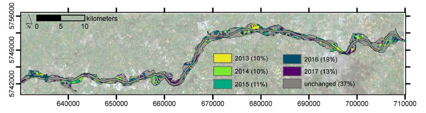
Example of the outputs indicating the changing vegetation classes for the analyzed year. (Source: Wimala van Iersel).
Related Content
Publication
Preliminary results are available as conference proceeding:
van Iersel, W.K., Addink, E.A., Straatsma, M.W. & Middelkoop, H. (2018). Monitoring floodplain vegetation change at river-reach scale. GEOBIA 2018 – GEOBIA in a changing world.
Related outputs
Monitoring height and greenness of low floodplain vegetation with a time series of drone images
We identified at a plot scale the seasonal changes in the terrain, vegetation height, and greenness in a simple way.
30/04/2018 by Wimala van Iersel et al.
![]()
Contains: Dataset upon request Publication open access
Classification of river floodplain low vegetation using seasonal drone imagery
A practical solution for monitoring areas of a few kilometers and derive land cover classification with high accuracies.
19/07/2019 by Wimala van Iersel et al.
![]()
Contains: Dataset upon request Publication open access
Last modified: 03/06/2019